Visually stunning infographics and maps are probably one of the best ways we can pick up information. I’d take that over boring texts any day!
This collection of 54 maps will show you which countries are best for babies, the most and least crowded places, and even what the world looked like 300 million years ago. I guarantee you will learn something new by the end of this post.
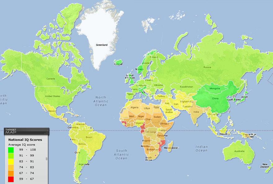
1. World Map Of National IQ Scores
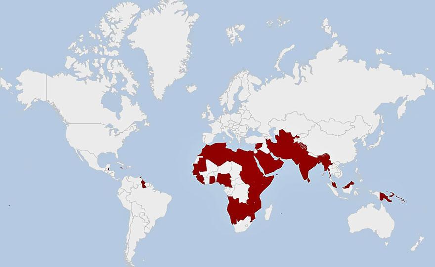
2. Countries Where Homosexuality Is A Crime
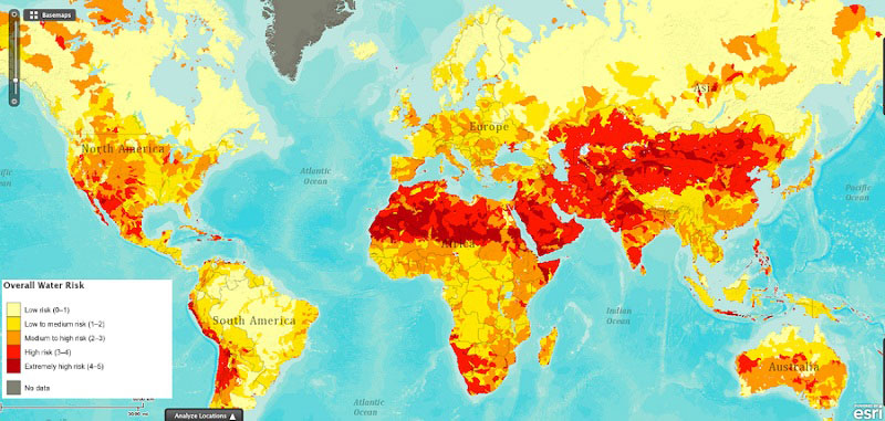
3. Drought Risk Around The World
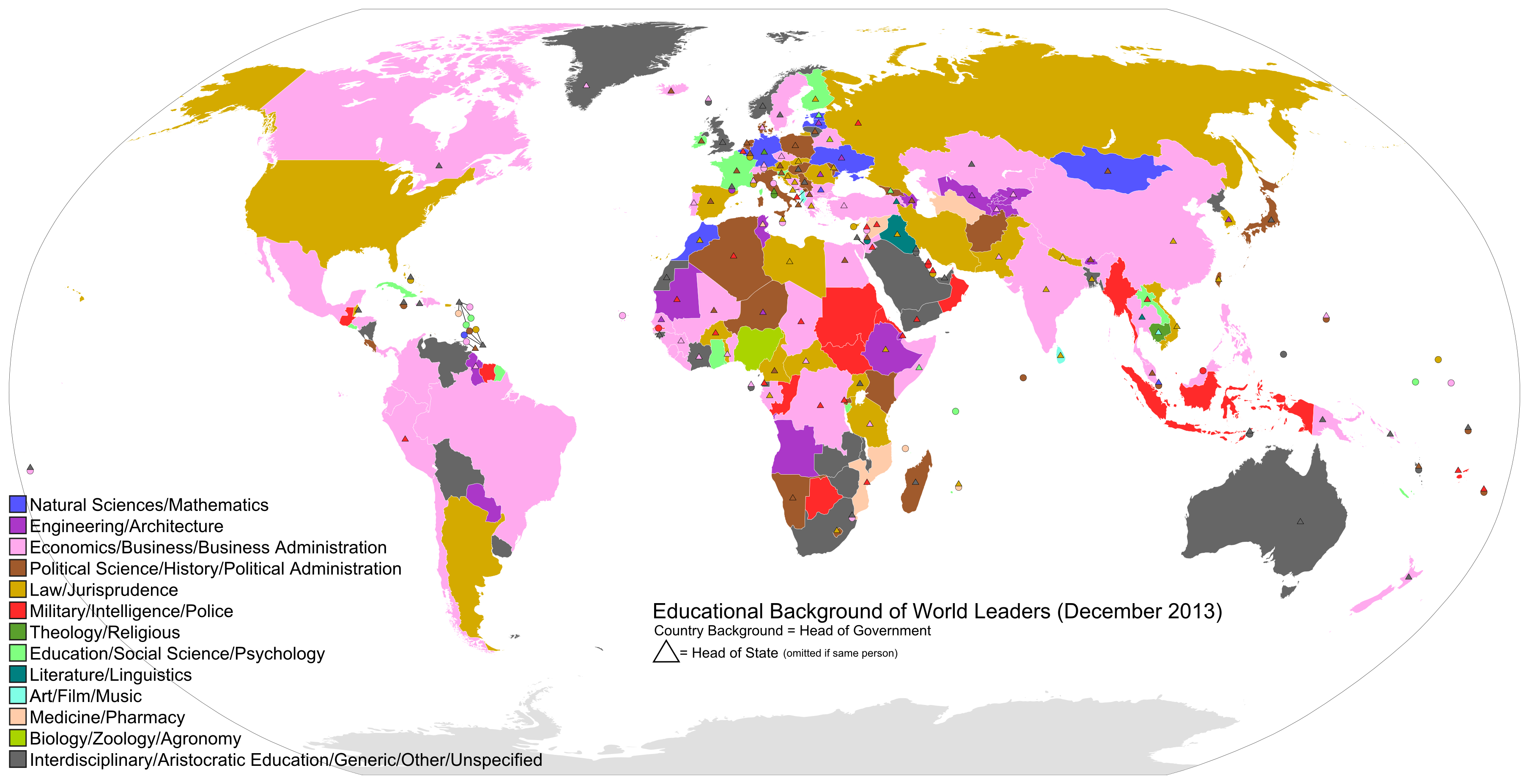
4. Educational Backgrounds Of World Leaders
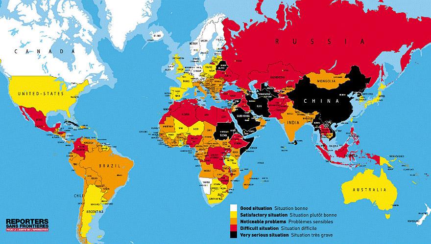
5. Freedom Of Press By Country
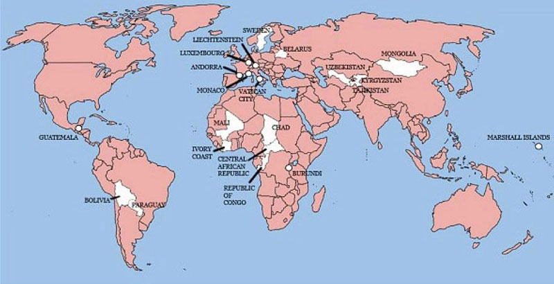
6. The Only 22 Countries In The World Britain Has Not Invaded
Note: Sao Tome and Principe are not shown.
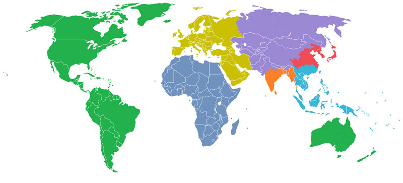
7. The World Divided Into 7 Regions Each With A Population Of 1 Billion
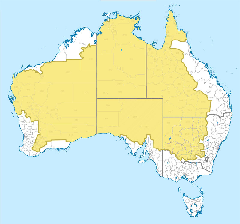
8. Where 2 Percent Of Australia’s Population Lives
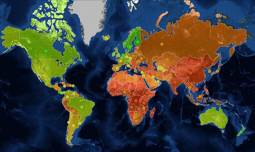
9. World Happiness Map
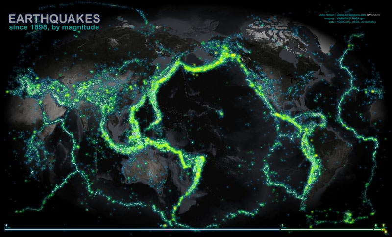
10. World Map Of Earthquakes Since 1898
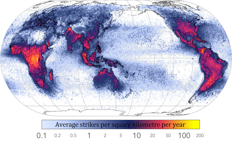
11. Frequency Of Lightning Strikes Throughout The World
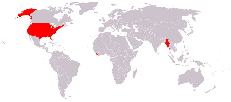
12. Countries That Do Not Use The Metric System
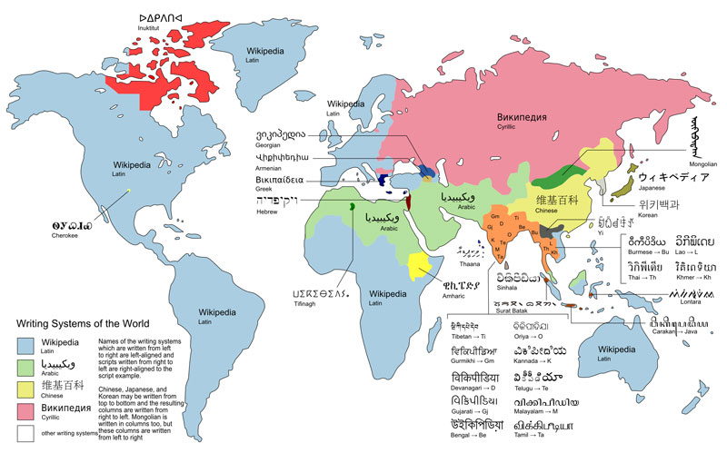
13. World Map Of The Different Writing Systems
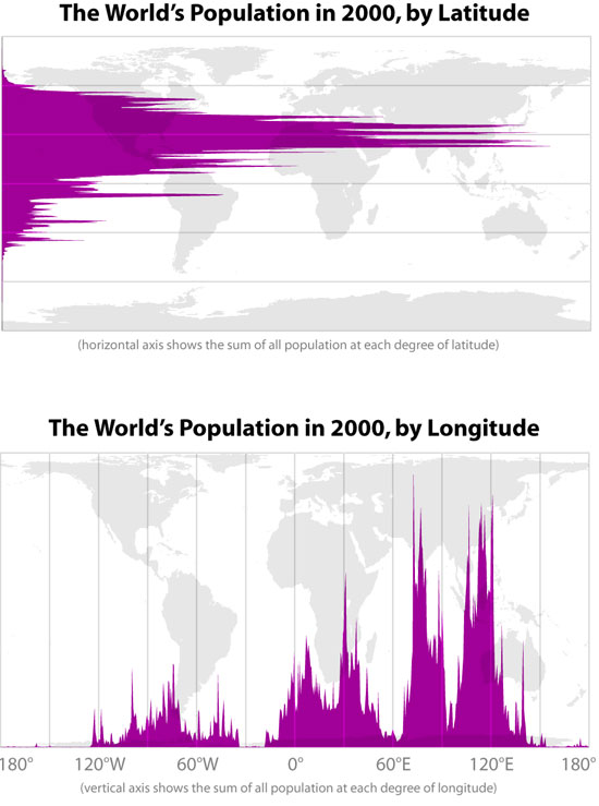
14. World's Population By Latitude And Longitude
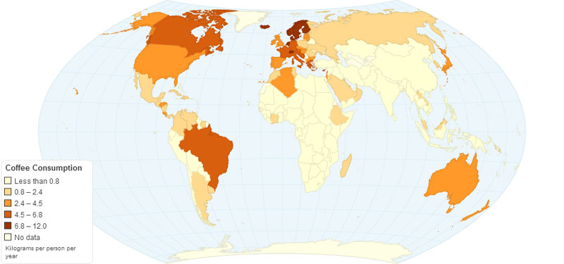
15. Worldwide Annual Coffee Consumption Per Capita
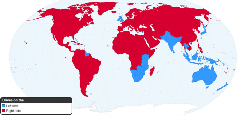
16. Worldwide Driving Orientation By Country
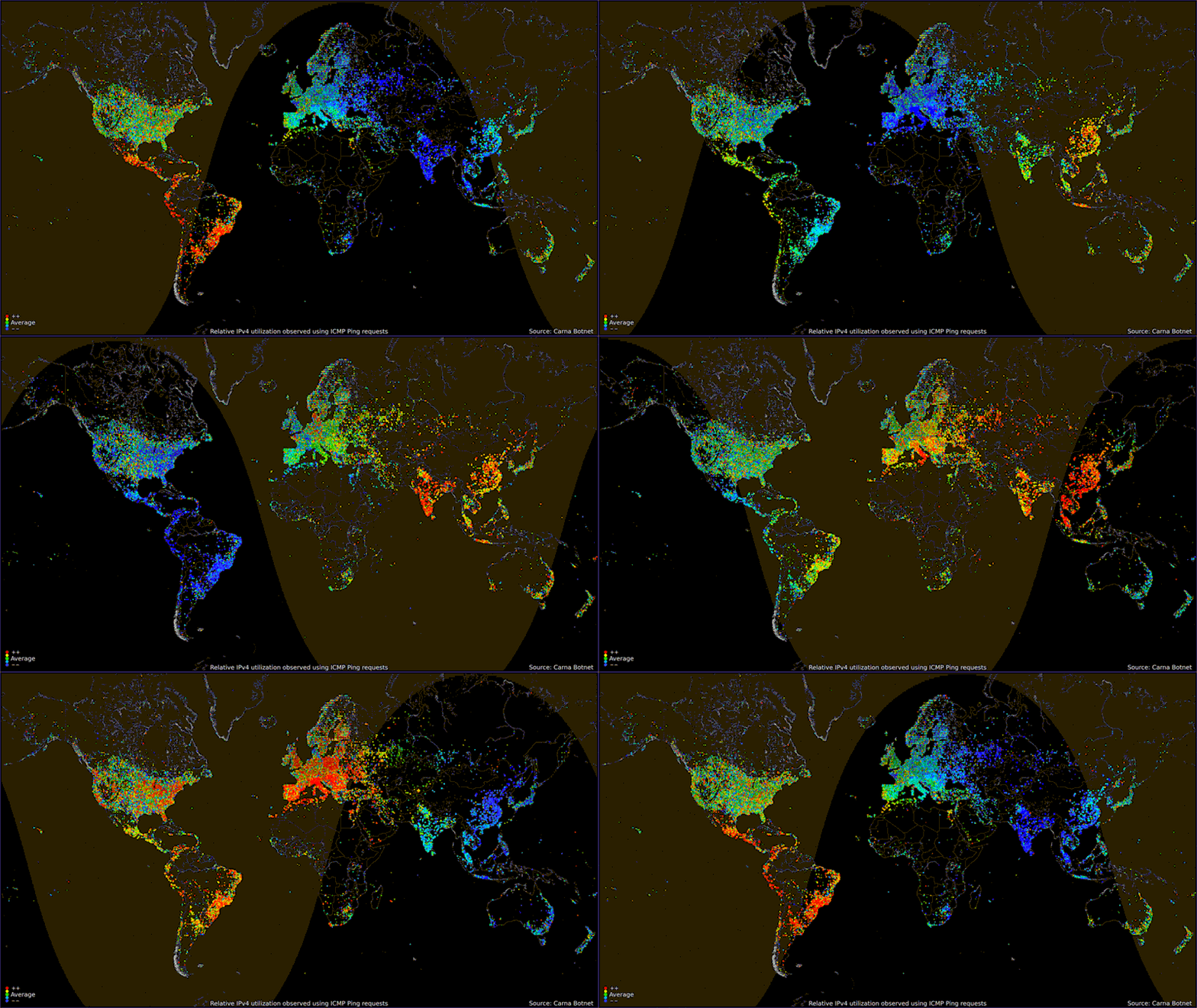
17. Worldwide Internet Usage Based On Time Of Day
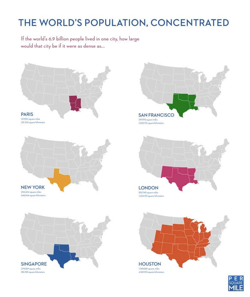
18. If The World’s Population Lived In One City
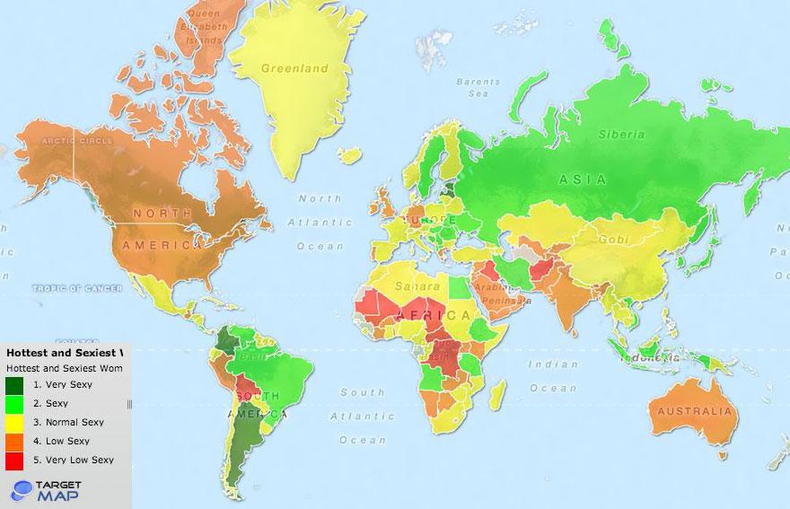
19. World's Hottest And Sexiest Women By Country
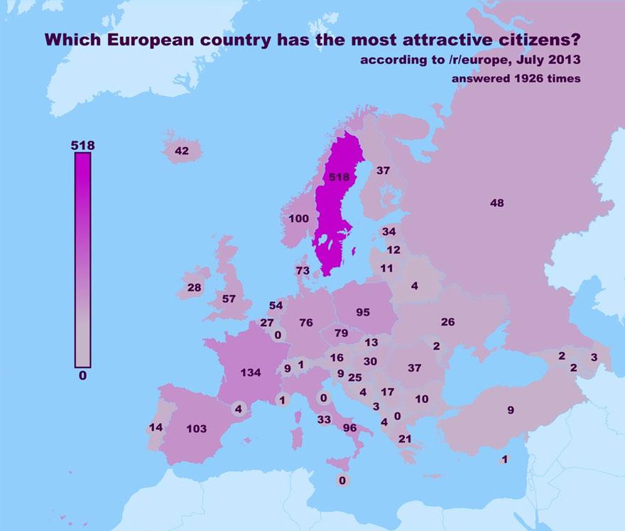
20. Most Attractive Citizens In Europe By Country (According to Reddit survey)
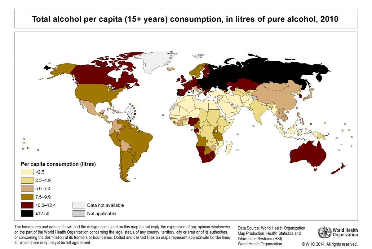
21. Map Of Alcohol Consumption Around The World
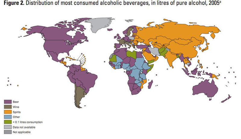
22. Map Of Alcoholic Drink Popularity By Country
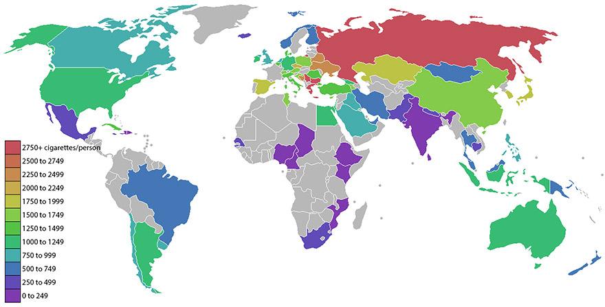
23. Cigarettes Smoked Per Person
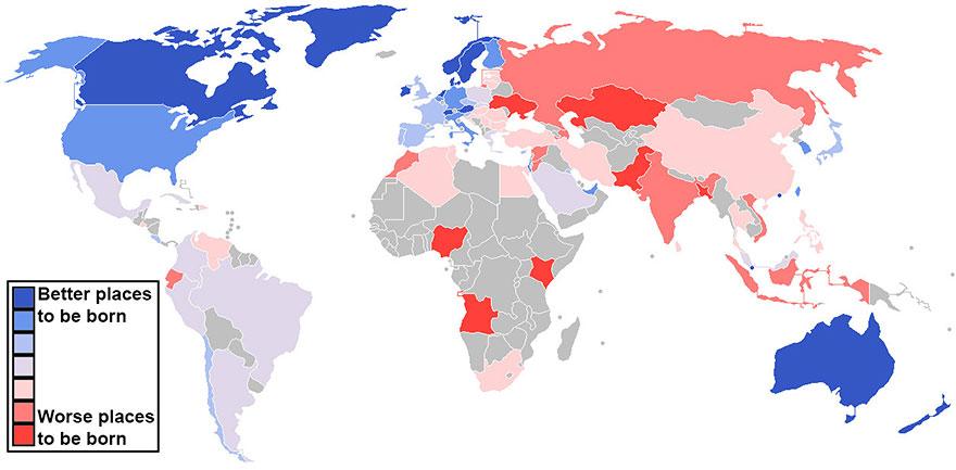
24. Best And Worst Countries To Be Born
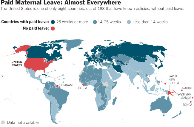
25. Paid Maternity Leave Around The World
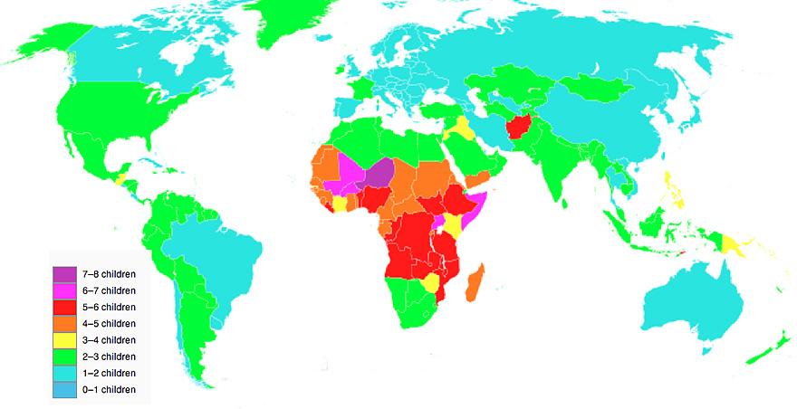
26. Map Of Total Fertility Rate
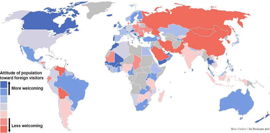
27. Map Of Countries Most And Least Welcoming To Foreigners
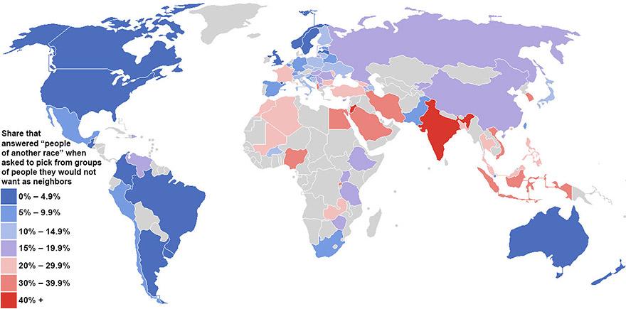
28. Greatest And Lowest Racial Tolerance By Country
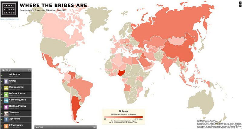
29. Map Of Countries With The Most Violations Of Bribery
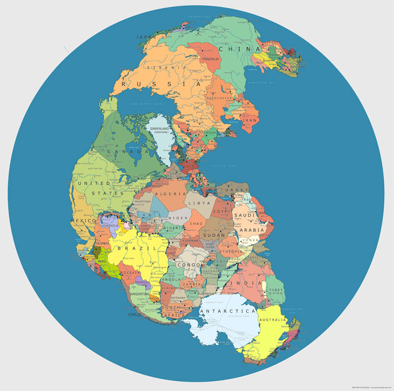
30. Map Of Supercontinent Pangea 200-300 Million Years Ago With Current International Borders
Pangea was a supercontinent that existed during the late Paleozoic and early Mesozoic eras, forming about 300 million years ago. It began to break apart around 200 million years ago. The single global ocean which surrounded Pangaea is accordingly named Panthalassa.
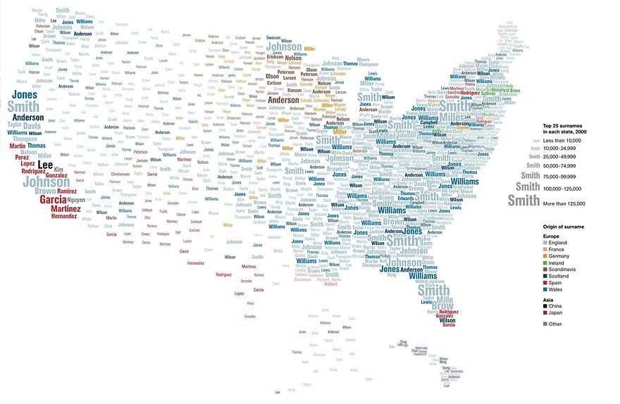
31. Most Popular Surnames In The United States
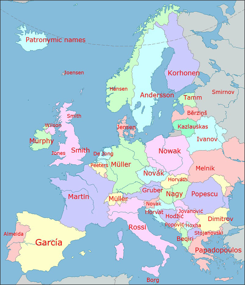
32. Most Common Surnames In Europe By Country
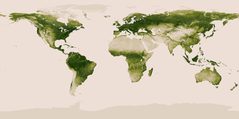
33. Map Of Vegetation On Earth
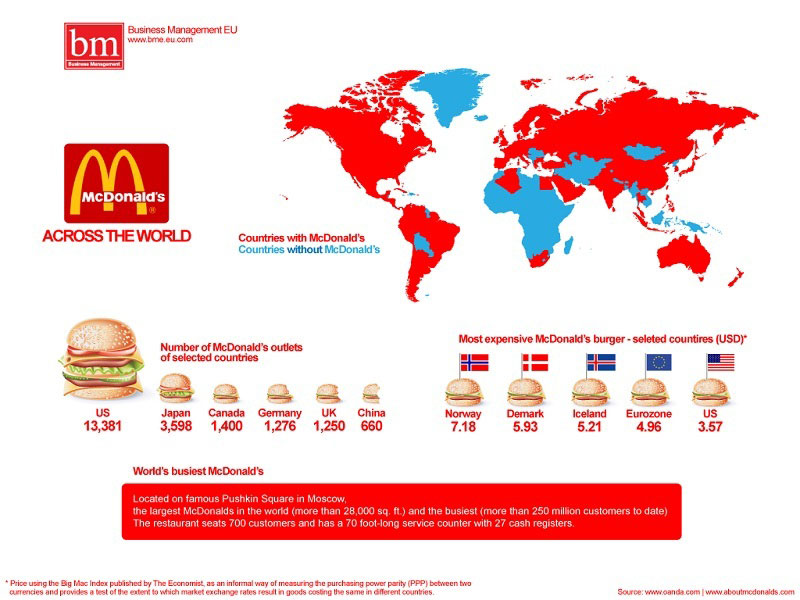
34. McDonald’s Restaurants Across The World
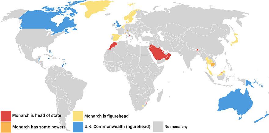
35. Monarchies In The World
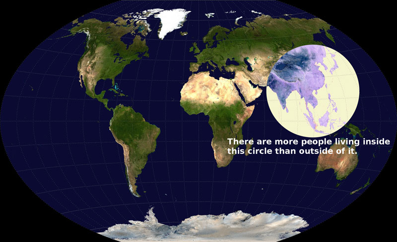
36. More People Live Inside This Circle Than Outside Of It
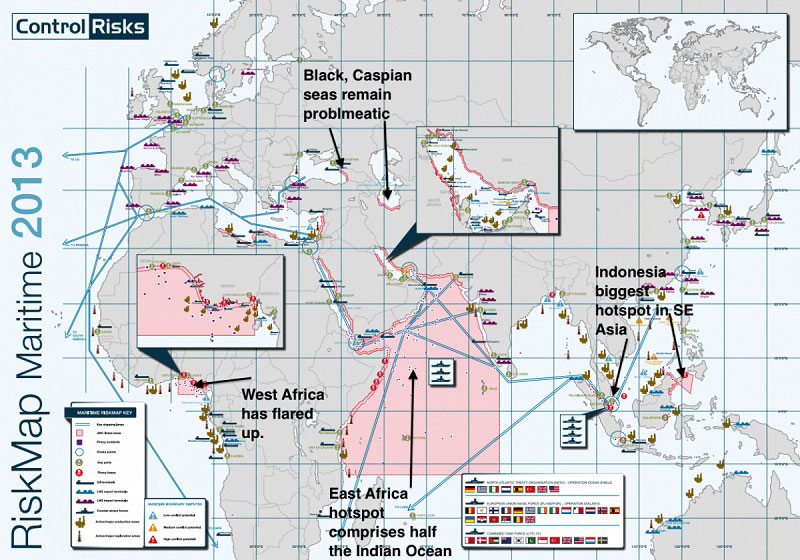
37. Most Dangerous Areas In The World To Ship Due To Pirates
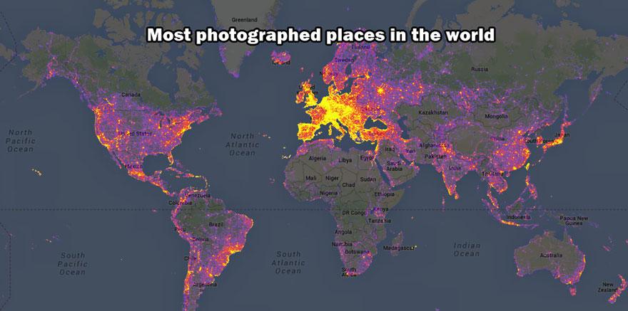
38. Most Photographed Places In The World
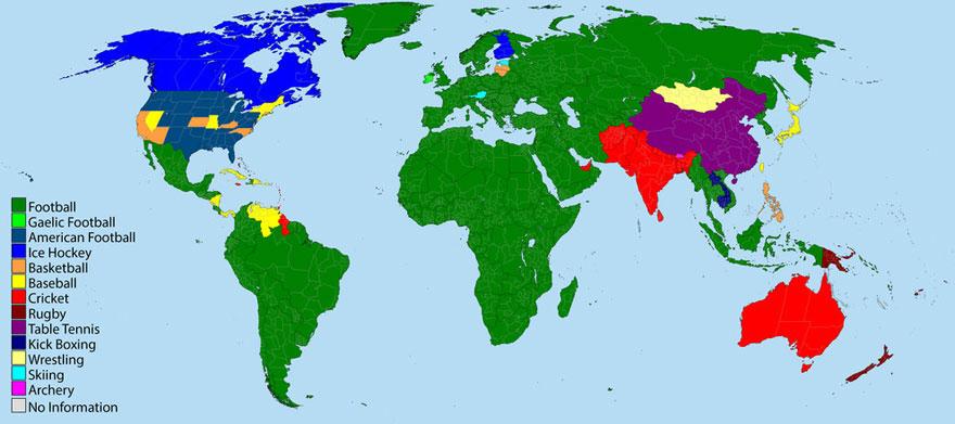
39. Most Popular Sports In The World
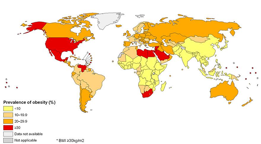
40. Obesity Around The World
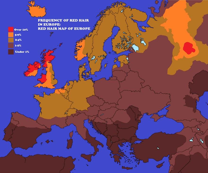
41. Red Hair Map Of Europe
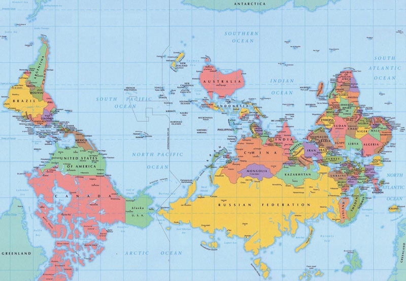
42. Reversed Map With Southern Hemisphere At Top Of Map (Because Position Of North Is Arbitrary)
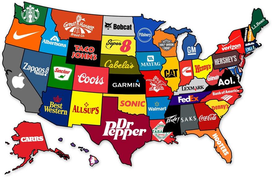
43. The Most Famous Brand From Each State In The US
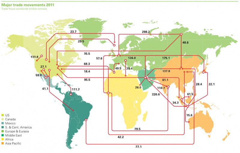
44. Worldwide Map Of Oil Import And Export Flows
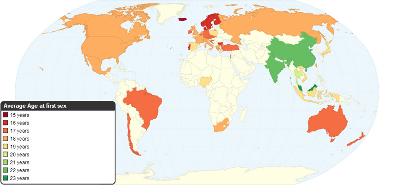
45. Average Age Of First Sexual Intercourse By Country
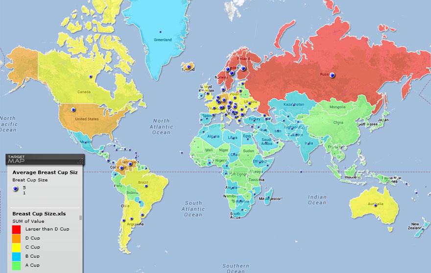
46. Average Breast Sizes By Country
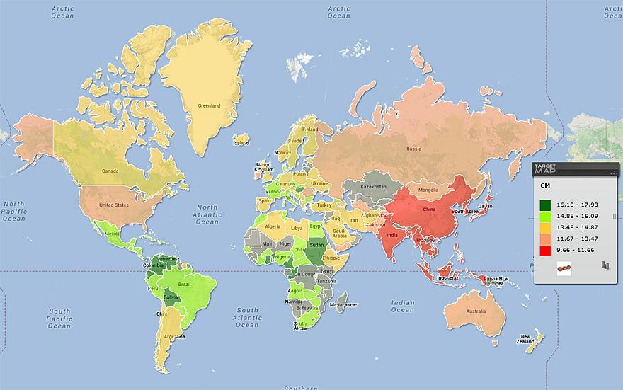
47. Average Penis Sizes By Country
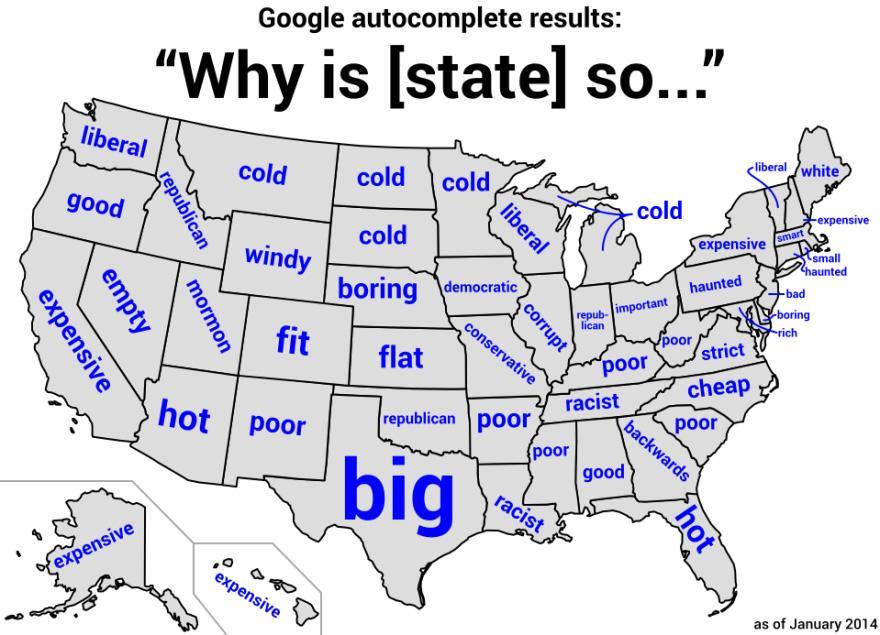
48. Google Autocomplete Results For US States
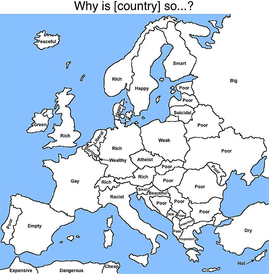
49. Google Autocomplete Results For European Countries
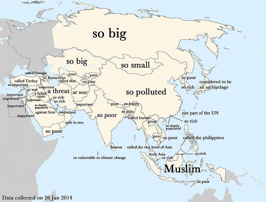
50. Google Autocomplete Results For Asian Countries
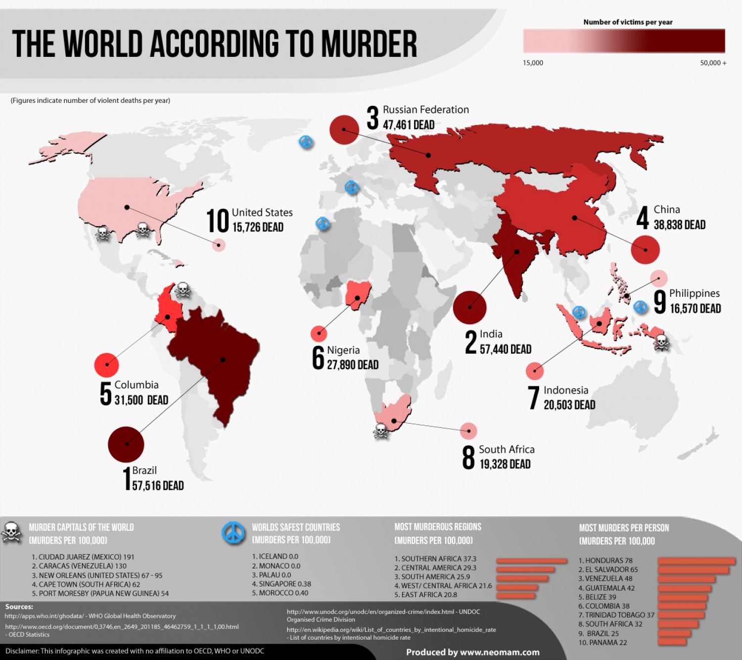
51. The World According To Murder
These are the most dangerous cities in the world.
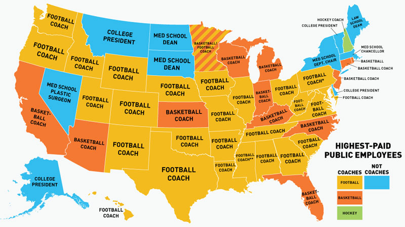
52. Highest-Paid U.S. Public Employees By State
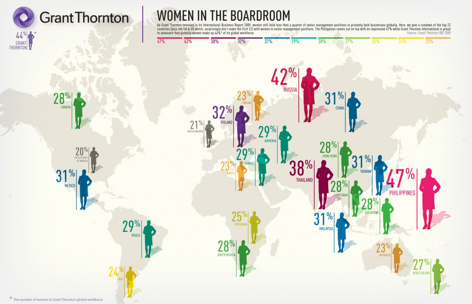
53. Women In The Boardroom By Country
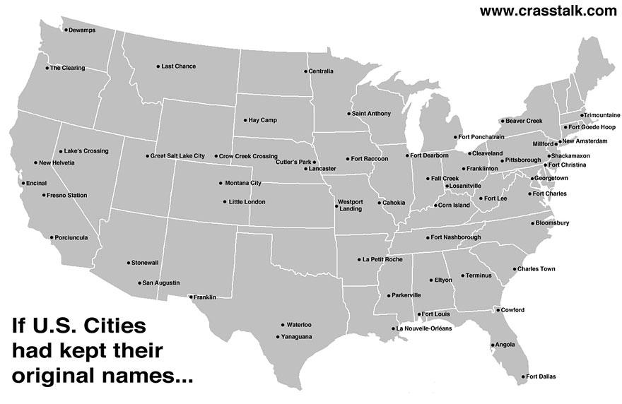
54. If US Cities Had Kept Their Original Names
If you learned something new about the world, share this collection of maps with others so that they will learn too.
